
Land Surveying
Our Surveying Department offers all necessary survey
designation related to the purchase, design and construction of
public and private properties. Our field staff consists of
experienced, knowledgeable personnel who utilize the latest in
modern equipment and data collection techniques. The office
staff works closely with the field crews to maintain the highest
standard for all projects.
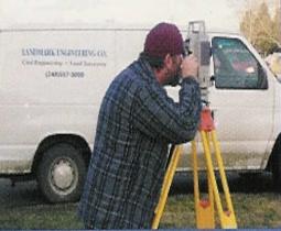
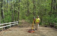
Using modern electronic surveying and data collection tools, our
surveyors consistently deliver timely and accurate data on a
diverse variety of projects. With computer and cellular phone
support, they are connected seamlessly with designers at our
headquarters facility, enabling them to download boundary and
topography data digitally, and receive design plan downloads for
construction staking. This system allows our field staff to be fast,
efficient and dedicated to getting it right.
Our Surveying Department offers all necessary survey
designation related to the purchase, design and construction of
public and private properties. Our field staff consists of
experienced, knowledgeable personnel who utilize the latest in
modern equipment and data collection techniques. The office
staff works closely with the field crews to maintain the highest
standard for all projects.
Using modern electronic surveying and data collection tools, our
surveyors consistently deliver timely and accurate data on a
diverse variety of projects. With computer and cellular phone
support, they are connected seamlessly with designers at our
headquarters facility, enabling them to download boundary and
topography data digitally, and receive design plan downloads for
construction staking. This system allows our field staff to be fast,
efficient and dedicated to getting it right.
Landmark Engineering Co. Provides complete land
surveying services. Our land surveying services
can be tailored to meet our client's specific needs.
The following is a list of land surveying services
we provide:
surveying services. Our land surveying services
can be tailored to meet our client's specific needs.
The following is a list of land surveying services
we provide:
- Boundary Surveys
- Topographic Surveys
- Tree Surveys
- Utility Surveys
- Commercial, Industrial, Residential,
- Institutional, and Municipal Surveys
- Architectural Surveys
- Property and Easement Descriptions
- Mortgage Reports
- Construction Staking
- ALTA/ACSM Land Title Surveys
- Flood elevation Certification
- Accident Site Surveys
- As Built Surveys
- Flood Plain Surveys
- GPS services

| Send mail to hodeh@landmarkengineeringco.com with questions or comments about this web site. Copyright © 2018 LANDMARK ENGINEERING CO. Last modified: 09/04/18 |
 |